http://www.esri.com/news/arcuser/0110/cartograms.html
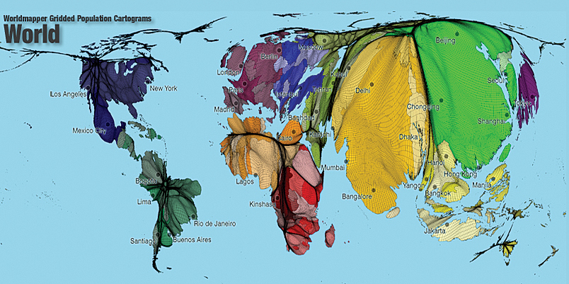
This map is an example of a cartogram. The boundaries of a cartogram map are exaggerated, showing a relationship between data or values, making a country smaller or larger than it really is. This cartogram represents the World's population, showing that Asia, India, and Russia are twice as large as other continents, meaning a higher percentage of the population live in those areas.
No comments:
Post a Comment